Another Trying Season, La Nina Now Through Summer
The good folks over at the National Weather Service have posted that La Nina, the ENSO negative Pacific Ocean pattern is here to stay for a threepeat.
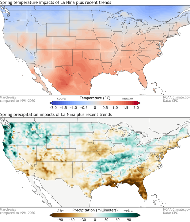
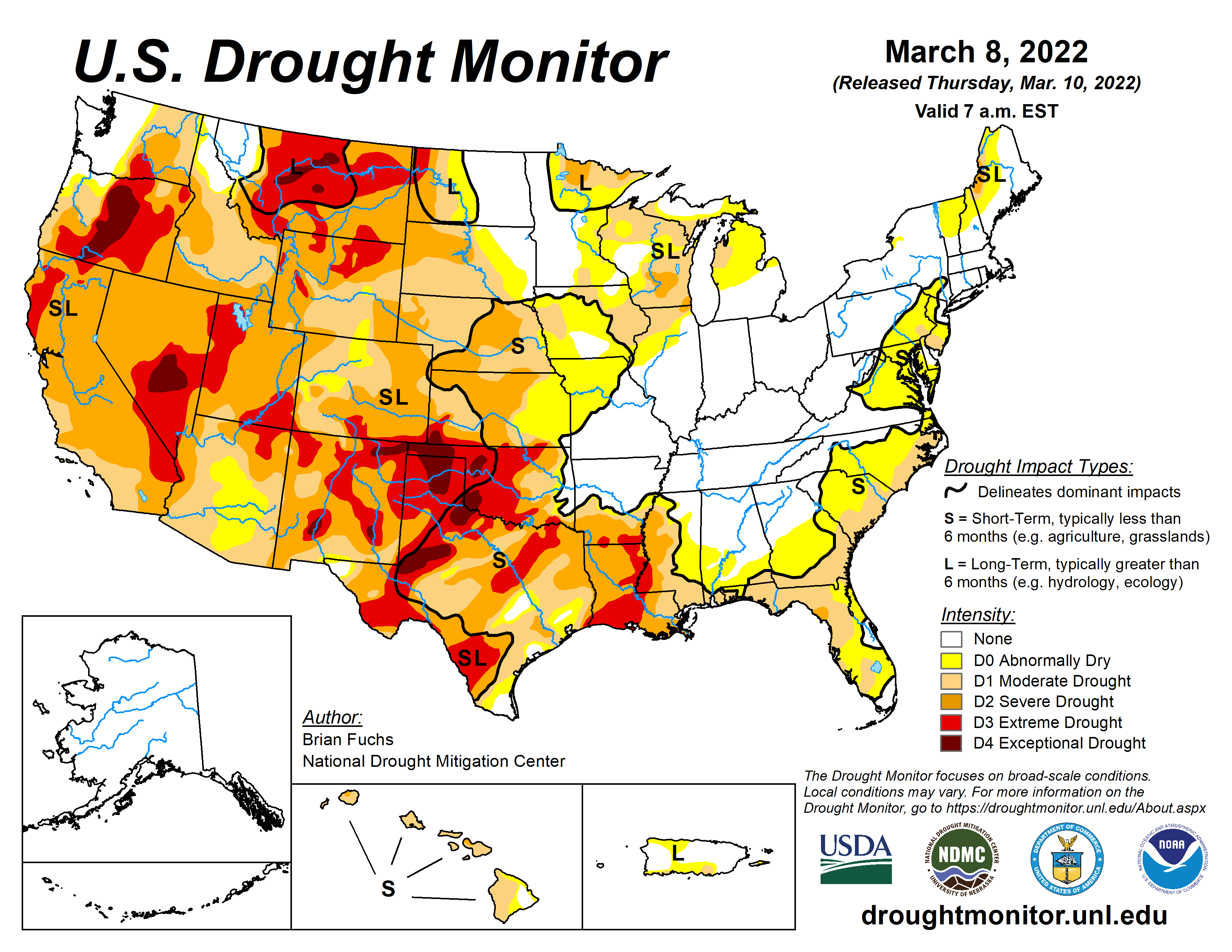
What this typically means for us in the US is that we are looking at drought. More drought. From the Texas South to the Dakota’s. This also means more rainfall in northern spots, flooding in the Ohio River Valley, much like we saw in Tennessee last year, and an uptick in hurricane activity coming off the gulf.
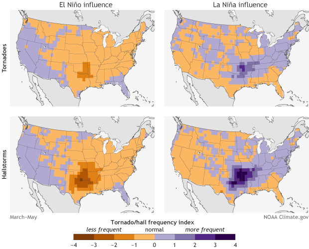
El Nino is the opposite positive effect that pushes atmospheric waves over the Rockies to descind down into the plains to convect the warm, moist Gulf onshore flows. We see this in Texas as regular fronts with squalls of good soaking rains. In the Corn Belt, El Nino reduces the chances for tornadic breakouts per research by Allen, Tippet, and Sobel.
La Nina setting up much as it has the past two cycles unfortunately increases the already drought stricken West and Southern US.
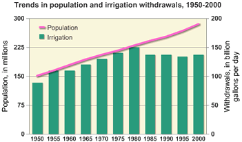
A third year of La Nina isn’t unprecedented, this has happened in 1973-76, and most recently in 1998-2001. What is different is that the current irrigated versus rainfed croppage spread is widening as more land needs to be irrigated to produce more bushels of beans and corn.
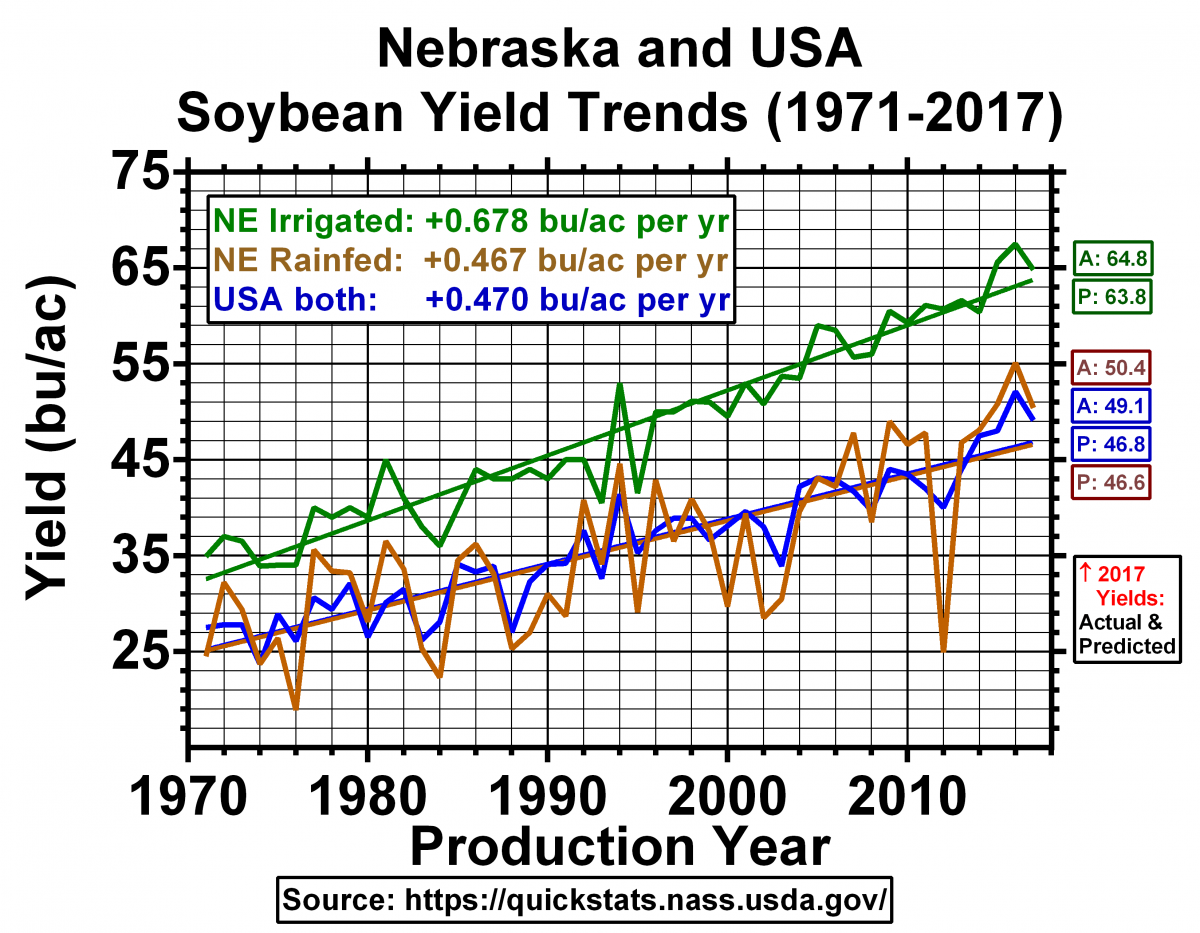
This metric also shows how we have been able to use Bt (blight tolerant), Dt (drought tolerant), and other genetically modified strains of silage to achieve more with less in the overall production. To note, we are actually in a holding pattern from irrigation draws and down from peak freshwater usage.
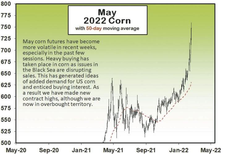
In looking at the initial data this year, and collectively sewing prior years experience, I expect this year to be a repeat of last year, where yields are up, mostly because commodities prices are at all time highs. Take for example the futures market on May ’22 corn:
Because corn and soybeans make up a significant share of the oils markets, ethanol, and are primaries in livestock silage feed, the expectation is that food inflation is likely to get worse. As I sit now, it is hard to exactly forecast without knowing the planted report from the USDA, as the seed drilling has only begun in the south and as the frost line moves north, more farmers wait to get seed in the ground likely next month. There is a call for more producers to plant more acres, but last year we were at an almost all time high.
Fortunately, what we are seeing on the ground is a good amount of activity. Drought will likely add some headwinds as well as the ongoing conflict in Ukraine. We will now sacrifice the Ancient Jackfruit to the rain gods.
La Niña, not Nina.
Tilde implied.
i pay pretty close attention to the ENSO cycle, but not really for growing season impacts on a personal level; i’m more concerned about the severity of our winters, and La Nina winters tend to increase the likelihood that i’ll be snowed in for an extended period…La Nina winters result in that warm and dry band through the south that you’re citing, but for the Great Lakes states they bring colder and wetter weather vs the average….the first half of this past winter wasn’t so bad, surprisingly little snow, but the curtain came down in January and left me with snow covering part of my garden area until just a few days ago…last year i started tilling late February…
i’m a weather radar addict, often check it several times a day (yes, the weather here does change that often), and what i’ve noticed is that every time a regional rain pattern set in, flood warnings went up over most of the Ohio valley region…several rivers still remain in flood stage, as does the Mississippi below the Ohio river confluence….all that tells me the ground in this entire region remains saturated, and that absent a quick dryout, spring plantings will be delayed…
if you can hold out long enough, Michael, it’s expected to get better…
The mid-Atlantic has not been getting typical weather resulting from the ENSO cycles. In general, the Southeast and Mid-Atlantic regions are picking up more than the amount of rain that the west has lost. Summers are beastly hot and winter cold begins just a little late, but then holds on tight until spring. We just had an inch of rain here this AM in central VA and now the temps are dropping rapidly with snow to start soon followed by a low in the teens tonight.